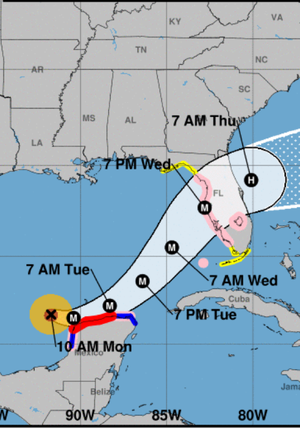
Tampa did a simulation in 2020. Read this and compare to Milton.
Phoenix 2.0 is the latest simulation of what would happen if a Category 5 storm were to make landfall here: flooding, destruction and a decade of rebuilding.

www.tampabay.com
"The water would rise so dramatically that most of downtown and South Tampa would be under at least 12 to 15 feet of water, according to a Federal Emergency Management Agency software tool used to estimate losses from potential disasters.
The edges of the South Tampa peninsula, all of Davis and Harbour islands, the Channel District and the banks of the Hillsborough River would see water 21 feet or higher.
Westchase and Oldsmar would be entirely underwater, with surge extending all the way inland to Gunn Highway.
One would be able to swim U.S. 41 from the Manatee River to the Ikea store in Ybor City.
The swollen Tampa Bay would meet the Gulf of Mexico in Seminole, swallowing much of mid Pinellas County: The Gateway area, Feather Sound, Pinellas Park, Lealman, Kenneth City and east Largo would all be under water, plus everything south of 22nd Avenue S in St. Petersburg. The intersection of Fifth Avenue N and 34th Street would be the center of St. Pete Island.
The highest surge would hit 42 feet.
The beaches as we know them would be gone."

