Navigation
Install the app
How to install the app on iOS
Follow along with the video below to see how to install our site as a web app on your home screen.
Note: This feature may not be available in some browsers.
More options
You are using an out of date browser. It may not display this or other websites correctly.
You should upgrade or use an alternative browser.
You should upgrade or use an alternative browser.
The Weather Thread
- Thread starter nycfan
- Start date
- Replies: 2K
- Views: 82K
- Off-Topic
CarolinaFever
Legend of ZZL
- Messages
- 6,842
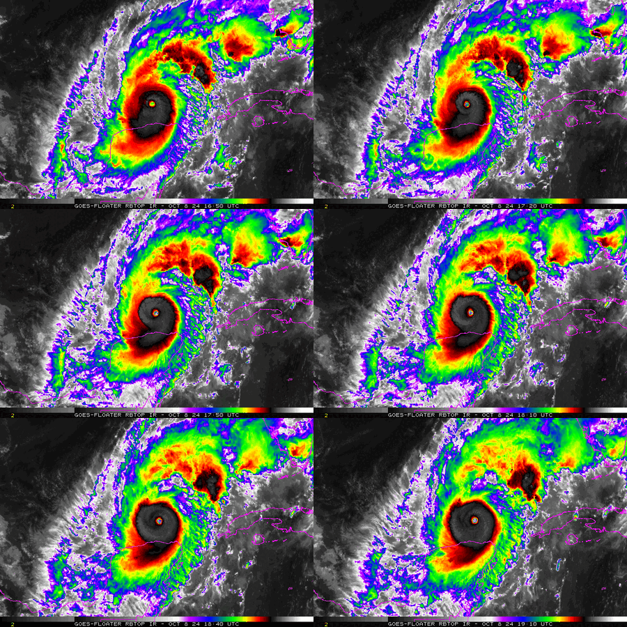
SUMMARY OF 100 PM CDT...1800 UTC...INFORMATION
----------------------------------------------
LOCATION...22.5N 88.2W
ABOUT 125 MI...205 KM NE OF PROGRESO MEXICO
ABOUT 520 MI...840 KM SW OF TAMPA FLORIDA
MAXIMUM SUSTAINED WINDS...155 MPH...250 KM/H
PRESENT MOVEMENT...ENE OR 65 DEGREES AT 8 MPH...13 KM/H
MINIMUM CENTRAL PRESSURE...923 MB...27.26 INCHES
CarolinaFever
Legend of ZZL
- Messages
- 6,842
That one dude was holding on to that cooler so his beer wouldn't fly out.
1moretimeagain
Inconceivable Member
- Messages
- 4,749
Florida is providing fuel trucks with police escorts. That would be a sight to see going by.
circlesky88
Esteemed Member
- Messages
- 619
Seeing some rumblings of the forecast track may be moved a little south, it is not making the turn as quickly NE as they were predicting.
CarolinaFever
Legend of ZZL
- Messages
- 6,842
- Messages
- 8,428
Jeez almighty. That thing just looks terrifying. Hard to imagine what is in store for tomorrow night in Tampa.
CarolinaFever
Legend of ZZL
- Messages
- 6,842
Yeah, he is starting to hulk up again.
theel4life
Inconceivable Member
- Messages
- 3,051
That is good for TampaSeeing some rumblings of the forecast track may be moved a little south, it is not making the turn as quickly NE as they were predicting.
theel4life
Inconceivable Member
- Messages
- 3,051
He has worked so hard creating this hurricane. Give him a break.Might be time for Sleepy Joe to wake up and break out the Presidential Sharpie soon.
circlesky88
Esteemed Member
- Messages
- 619
Maybe, maybe notThat is good for Tampa
CarolinaFever
Legend of ZZL
- Messages
- 6,842
Milton is back to a cat 5 at 165 mph.
1moretimeagain
Inconceivable Member
- Messages
- 4,749
- Messages
- 8,428
They’re way ahead of you. Got themselves a fence.
Lord have mercy....
fourheels
Iconic Member
- Messages
- 1,012
They’re way ahead of you. Got themselves a fence.
Hope they have a ton of flex seal
Hitting 20-30 miles south of Tampa Bay likely dramatically changes (reduces) the storm surge in the Tampa Bay area…….this storm is going to be devastating, regardless.Maybe, maybe not
JCTarheel82
Inconceivable Member
- Messages
- 2,804
They’re way ahead of you. Got themselves a fence.
Milton is about to do his Kool-Aid Man impression.
Share:


