Navigation
Install the app
How to install the app on iOS
Follow along with the video below to see how to install our site as a web app on your home screen.
Note: This feature may not be available in some browsers.
More options
You are using an out of date browser. It may not display this or other websites correctly.
You should upgrade or use an alternative browser.
You should upgrade or use an alternative browser.
The Weather Thread
- Thread starter nycfan
- Start date
- Replies: 2K
- Views: 82K
- Off-Topic
CarolinaFever
Legend of ZZL
- Messages
- 6,867
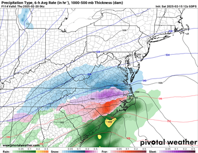
The models keep showing ice for most of central and western NC. Hopefully it will be colder and it won't be the amount of ice shown on the models and some snow will mix in with it.
circlesky88
Esteemed Member
- Messages
- 619
Three quarters an inch of ice would be no bueno
CarolinaFever
Legend of ZZL
- Messages
- 6,867
CarolinaFever
Legend of ZZL
- Messages
- 6,867
CarolinaFever
Legend of ZZL
- Messages
- 6,867
DougDaBroadcasta
Distinguished Member
- Messages
- 350
Wolfslayer
Well-Known Member
- Messages
- 88
- Messages
- 1,102
Nothing like knicking back some Irish coffee when it's snowing. Kaluah is nice as well.Looks like we could hammered here in RVA.
- Messages
- 4,350
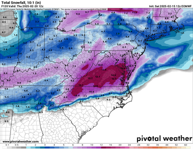
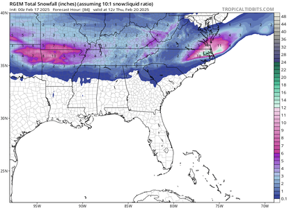
That shows 4” for Charlotte and 12” for Salisbury. That’s 40 miles and no change in elevation. I see the predicted highs in CLT next Wed/Thu is 37/38. We are not getting 4” of snow if it’s 6-8 degrees above freezing. I’m calling BS on snow next week. We will see rain and a little ice.
CarolinaFever
Legend of ZZL
- Messages
- 6,867
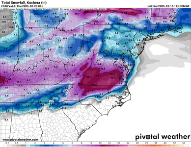
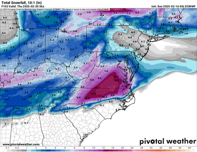
Models continue to fall in line with the Euro. Looking like the Triangle and NE into VA is going to get a lot of snow.
CarolinaFever
Legend of ZZL
- Messages
- 6,867
circlesky88
Esteemed Member
- Messages
- 619
At least the trend for the Triangle is trending away from devastating ice fur now
Share:

